Solano Canyon
  • Home
  • About
  • History
    • Timeline
    • Street Name Histories >
      • Solano Avenue
      • Buena Vista Road
    • People of Solano >
      • Francisco Solano
      • Rosa Casanova
      • Alfredo Solano
      • María Solano
      • Guillermo Bouett
    • Photos
  • Blog
  • 1866 Org.
  • City Service Requests

Lupe and Pilar García

5/26/2015

Comments


A la Loma family story
A new beginning; displacement; and heartbreak

On Sunday, I told the story of how the man on the cover of Don Normark's classic book, Chávez Ravine, 1949:  A Los Angeles Story, was positively identified by two of his daughters as Guadalupe García.  Today, I will tell you a little about Lupe's family and the relatively short time they lived in la Loma, one of the Chávez Ravine communities that was destroyed during the 1950s to make way, eventually, for the construction of Dodger Stadium.

It is a story of one family's new beginnings — first by a happy, new life in the Chávez Ravine community of la Loma, then followed by displacement and the heartbreak of eviction at the hands of their adopted city, Los Angeles.

Meet Guadalupe García and Pilar de León

Lupe and Pilar
Guadalupe García and Pilar de León [photo courtesy the García family]
This lovely photograph of Lupe García and Pilar de León is undated; but if there is any doubt about the identity of the man on the cover of Normark's book, compare this photo with the one in the blog Who is this man?.

Lupe García was born in 1913 in México, probably in Aguascalientes, although his birth record has not been located.  He is the son of Librado Garciá and his wife, Juanita.  Pilar de León was born in 1912 in Goliad County, Texas, the daughter of Juan de León and Carlota Bocanegra, who are from México.  In the 1930 US census of Texas, Lupe and Pilar are found living near each other in rural Edna, jackson County, Texas.

Lupe's parents, Librado and Juanita, immigrated to the United States in 1916, when Lupe was a small child.  They had been married 32 years in 1930, and their last child, David, was born in Texas in 1918.

On the other hand, Pilar de León's parents, Juan and Carlota, immigrated in 1887, when they were both very young, and so they must have married in Texas.  They were the parents of nine children, three girls and six boys, born between 1910 and 1928.   Pilar was their second child; she has an older sister, Luisa.

Lupe and Pilar married sometime between 1930 and 1935.  Over the next seven years, they had four children:  Mary Ann (1935), Guadalupe Gilberto (a boy, 1938), Madalena (known as Helen, 1940), and Librado D. (1942).

From Texas to Los Angeles

In 1945, Lupe and Pilar and their four children moved from Port Lavaca, Texas, to Los Angeles, settling temporarily with the de León family, Pilar's parents, Juan and Carlota, on Amador Street in Solano Canyon, sharing the house with three uncles who were recently returned from World War II, and others.  As Helen tells it, "I remember lots of people living there."
"I remember lots of people living there."  — Helen García
Shortly after their arrival, the García family moved to "... a small house behind the mission ...", according to Helen.  The mission she refers to is the San Conrado Church on Bouett Street in Solano Canyon.
"It was near the church."  — Mary Ann García

The family moves to la Loma

After living for a short time in the small, rented house behind the San Conrado Mission, Pilar located a two-story house on Spruce Street in la Loma, and the family moved once more.  The address of the house is not known with certainty, but it must have been in the 600 block.  The house was on the downhill side of Spruce Street and faced the street.  The lot went all the way to Phoenix Street and Helen says she remembers walking down the hill to attend Solano Avenue School.
"My mother had a friend, Mrs. Trujillo, who lived on Amador Street or Solano Avenue — I'm not sure — and it turned out that Mrs. Trujillo's daughter [Molly] married my uncle Elías.  Anyway, while that romance was going on, I got to know Mrs. Trujillo, and she would take me, once a week, downtown to the Mexican movies on Broadway."  — Helen García


Helen Garcia identifies her house

la Loma from Solano Canyon
A view of la Loma from Solano Canyon, circa 1930
Helen García noticed this photograph from an earlier blog, A Tour of Chavez Ravine in Under 2 Minutes.  The García home on Spruce Street is the two-story, white house near the top, left-hand corner of the photograph — the house that is partially obscured by a tree.  This is the house she identified as the family home on Spruce Street in la Loma.
The Garcia house on Spruce Street
The García house on Spruce Street in la Loma


Shangri-la becomes not-so-pleasant

The García family lived on Spruce Street in la Loma for nearly five years.  Helen García remembers fruit trees growing below their house, especially loquat, apricot, and sapote, which was Helen's favorite.  She also remembers the sound of bells on the goats that were kept further up the street, and of her playing on the street in front of the house.
"It was a playground to me ... I was sad to let go of the house and move."  — Helen García

"We were very happy there."  — Mary Ann García
Then, one day in 1950 or 1951, a man came to the house to tell the family they had to move.  It was the start of what became the eventual eviction and destruction of the homes of nearly 1,100 families in the Chavez Ravine communities of la Loma, Palo Verde, and Bishop.  Helen, then ten years old, doesn't remember much about the visit that day; but Mary Ann, Helen's sister and nearly five years her senior, has a vivid memory of the man and that time.
"All of a sudden, this man came over and said we had to go — we had to leave.  He was Anglo, tall, thin; he had a mustache.  He spoke with a brusque voice so that we would be afraid of him.  He introduced himself, but I don't remember his name.  I got angry, to think that someone like that could take our home away ... He said, 'We have to take your home away, because the military wants to use it for some training.'  He offered us $1,000.  I said, 'No, we need more money than that', so he said, 'Well, then, $2,000'.  I was so upset I had to leave.  I knew if I didn't get out of there, I would do something, I was so mad.  I don't know what [my parents] eventually got for the house."  — Mary Ann García
The perception of sixteen-year-old Mary Ann García paints a disturbing picture.  She saw the tall, thin Anglo man with a mustache as a threatening figure who was trying to intimidate her parents into selling their home for very little money.  How much money they eventually received for their house is not known, but Mary Ann's memories reveal a determined and heavy-handed effort to get nearly 1,100 mostly-Hispanic families off their properties

What was the real purpose of the evictions?  Was there perhaps a racial component to the plan?
"Years later, that house stood for so long, and here they didn't even do anything with that property.  You could see the house from the freeway.  We would always look over and see the house.  For many years, I would see it there; then, all of a sudden, it was gone.  It was a tiny little house, but it was a nice house."  — Helen García

An afterword

First-person accounts carry incredible power.  My thanks to sisters Mary Ann and Helen García for their memories and for their recorded accounts, and for their gracious permission to publish them here.

Update

Shortly after I published this blog about two hours ago, a dear friend of mine who lives in Solano Canyon sent me this photograph.  Compare it with the 1930s-era photograph, above.  More than 50 years after the evictions and the destruction have all been said and done, this is what la Loma looks like today — it's the same location as in the photographs, above.  And it's a shame.
la Loma, 2015
la Loma from Solano Canyon, 2015
Comments

Who is this man?

5/24/2015

Comments


Chávez Ravine, 1949
A Los Angeles Story by Don Normark

Chávez Ravine, 1949 cover

The mystery man on the cover

Anyone who has ever viewed Don Normark's now-classic 1999 volume of photographs and text, Chávez Ravine, 1949, A Los Angeles Story, has marveled at the iconic photograph on the dust jacket of a solitary man — a workman, perhaps — wearing a hat and carrying a lunch box and walking along a winding path toward a cluster of houses and, presumably, toward home.  Portions of the image are repeated on the front cover of the book and again on page 55.  It is a captivating image; but the man's identity is not revealed in the book.

Recently, a Seattle resident, Victor Rini, Googled 'Chavez Ravine' and was surprised at the amount of information he found there, including about the PBS 2003 Independent Lens documentary CHAVEZ RAVINE by Jordan Mechner.  One of Normark's images from the book appeared briefly in the film

Victor continued searching the Web for Normark's images, and he found these two:
Studying the two images, Victor thought, That looks like my grandfather, Lupe García.

On Mother's Day, 2015, he was able to show the images to his mother, Helen.  Her reaction was immediate:

"That's my father!" she said emphatically.

The following weekend, the images were shown to Victor's aunt and Helen's sister, Mary Ann.

"That's Dad!" she said.

And so it was confirmed by two of his daughters:  the image in the Normark book, and the second image, also taken by Normark, which shows the man from the front, is of la Loma resident Guadalupe García.

Mystery solved!


Where was Lupe García walking?

But the questions asked by many of us remained:  where was the path on which he was walking located, and to where was he going?

To try to solve that puzzle, I turned to a 1948 aerial photograph of the area:
1948 Aerial Photo
Portion of Los Angeles, 1948
Knowing where to look, I zoomed in to this area:
1948 photo, Solano Canyon area
Portion of the 1948 aerial photograph
This portion of the 1948 aerial photograph, while still quite busy, clearly shows all of Solano Canyon and la Loma as it appeared in 1948.  But where is the path?

The García family lived on Spruce Street in la Loma.  Victor's mother, Helen, described in detail the location of the family's home in relation to the topography of the area.  She also described how she walked, once every week, down the same path that her father walked every day to his job as a stevedore for the Southern Pacific Railroad.  She said that the path led down to Bishop's Road, and from there, she continued on to Savoy Street, where she took piano lessons in the Ocampo home from Professor Cantu.

Armed with this information, I located Bishop's Road on the photograph (it is the curving street at the bottom-left of the image).  The path had to connect Spruce Street, in la Loma near the reservoir, with Bishop's Road.

And there it was:  the path.
The path, annotated
The path from la Loma to Bishop's Road, 1948


The mystery is solved

So, through a series of coincidences, the least of which is not the fact that Victor knew of my blogs and went to the trouble to contact me, the mystery of the identity of the man on the cover of Don Normark's book has been solved.  In future blogs, I will discuss more about the García family history and genealogy.  It is an interesting story.

My many thanks to Victor; to his mother, Helen; and to his aunt, Mary Ann, for permission to present this information.


One final puzzle

There was one final puzzle that bothered me about  Normark's photogarphs of Lupe García:  why, in the photograph of Lupe's walking away from the camera, was he wearing suspenders, while in the photograph of his walking toward the camera, he was not?

I posed that question to Victor, who quickly answered it for me:  Lupe was a stevedore, and the "X" mark on his back was not suspenders; rather, it was sweat marks on his shirt from the straps on the apron that he wore while at work.
Comments

Equal treatment under the law?

5/22/2015

Comments

 
The right to be treated equally under the law is fundamental to American society.  It is probably safe to say that no one believes that he or she should be treated less-well than any other person.  We all know that, unfortunately, the desire (indeed the right) to be treated fairly is not always reflected in the actual treatment one receives; however, the goal of fairness is a laudable goal that we should always keep in mind and try to live by.

We live by the rule of law

We live under laws that derive from many levels of government — Federal, state, and local, to name but a few.  Although local laws usually take the form of ordinances, they are effectively laws, nevertheless.

One such ordinance is Los Angeles City Ordinance 183135.  This ordinance, effective on 08 July 2014, primarily governs parking issues at major sports and entertainment events in the City.  Interestingly, the ordinance specifically mentions "... events at major sports and entertainment venues, including Dodger Stadium [my emphasis] ...".  Two sections of the ordinance are of particular interest and warrant further inspection.  The Transportation Committee finds that:
5.  [T]he unrestricted parking of vehicles in the residentially [sic] developed neighborhoods adjacent to Dodger Stadium is causing traffic congestion, is resulting in a detriment to the public welfare from complaints associated with a significant increase in the number of parked vehicles during Dodger Stadium events including blocked driveways, excessive noise at night after the games, excessive litter and consumption of alcohol in vehicles, and is interfering with timely emergency vehicle access to and from the streets and residences in these neighborhoods for both Police and Fire Departments.
Further, the Committee finds that:
6.  [E]vents at major sports and entertainment venues, including Dodger Stadium, are defined as a Special Event by LAMC Section 41.20.1, and that the policy for Special
Events at these venues, is specified in LAMC Section 41.20.1.(c).
In other words, Dodger games are 'special events' under the provisions of this ordinance, and they are therefore subject to the provisions of the ordinance.  The ordinance goes on to say that the Los Angeles Department of Transportation (LADOT) is authorized to establish appropriate signage for such events and directed [i.e., required] to establish procedures to ensure the provisions of the ordinance are met.

Who is most affected adversely by Dodger Stadium game-day traffic?

Residents of two communities in particular — Echo Park and Solano Canyon — have long been seriously adversely affected by Dodger Stadium game-day traffic moving through the streets of their neighborhoods.  What is meant by 'adversely affected' is that local streets have been used for ingress and egress to- and from the stadium on game days, a purpose for which they were not designed.  The ordinance is specific in its description of the problems caused by this situation:
  • a significant increase in the number of parked vehicles [in local communities] during Dodger Stadium events;
  • blocked driveways;
  • excessive noise at night after the games [think also:  Friday night fireworks];
  • excessive litter; and, perhaps most important in terms of public safety,
  • [interference] with timely emergency vehicle access to and from the streets and residences in these neighborhoods for both Police and Fire Departments.
I would add one further bullet-point that was not enumerated in the ordinance, but which has been a point of contention with residents for years:
  • public urination.

What Echo Park has done

The community of Echo Park has, to its credit, already made use of the provisions of this ordinance.
Echo Park signage
In this photograph, a dozen happy residents (along with three dogs) are giving a hearty 'thumbs-up' for the signage above them on the lamppost.  But what does the signage, about which these residents are so happy, actually say?
Close-up of EC signage
The top (red) portion of the sign says,

NO PARKING ANY TIME DURING STADIUM EVENTS


Baseball games at Dodger Stadium are 'stadium events'.  OK, Dodger fans traveling to games in their cars cannot park on the marked streets in Echo Park.  The middle (green) portion says,

VEHICLES WITH DISTRICT 'D' PERMITS EXEMPTED

What is a 'District D' permit?  It's a permit that residents may obtain that allows them to park on the streets of their own community near their homes.  That's a nice touch.

Finally, the lower (yellow) portion of the sign says,

ENFORCED 4 HOURS BEFORE STADIUM EVENT TO END OF EVENT

What this all means is that, beginning four hours prior to any baseball game at Dodger Stadium, no parking on the marked streets in Echo Park is allowed for vehicles that do not display a resident permit.

This is excellent.  If the signage is obeyed — or, more to the point, if the rules elaborated on the signage are enforced — then the residents of Echo Park will have achieved some measure of peace within their community.

Is this victory?

Good for Echo Park!  But is this truly victory over the perennial problem of Dodger Stadium game-day traffic?  Not so fast ...

Remember, under the rule of law, what applies to one applies to all.  So what about the residents of Solano Canyon, who have been complaining about Dodger game-day traffic for as long as have the residents of Echo Park?  Echo Park is in CD13; Solano Canyon is in CD1.  The two communities are served by different City Council members, who apparently have differing priorities.  The 'bottom line' here is that Solano Canyon has yet to be granted any relief from Dodger Stadium traffic, even though there has been a DOT plan in place since 2013 to mitigate traffic on Solano Avenue from North Broadway on game days.
N Broadway DOT Plan
In practical terms, the DOT plan, above, has been abandoned, and in fact,  it was never rigorously enforced (see my blog, A Disaster Waiting to Happen).  Solano Canyon has never been granted any relief from Dodger Stadium game-day traffic.

What's a Solanero to do?

It would seem that there is but one thing to do:  complain, loudly and vociferously, to Gil Cedillo, the City Councilman for CD1.  One voice may, in fact, seem very small when pitted against a powerful and (apparently) disinterested force; but many voices — voices that reinforce each other — produce a sound of great volume that has a power that, in the end, cannot be ignored.  Solano Avenue and Casanova Street are not — and should never have been — conduits for traffic to Dodger Stadium.

And remember:  what is made available to one community should be made available to all communities.

More to come ...
Comments

Solano Canyon on 'Mad Men'?

5/6/2015

Comments

 
Well, no, not exactly.

In the blog Alfred Solano, patron of Solano Canyon that was posted on April 26th, there was a photoragph of Stimson House, the 30-room mansion at 2421 Figueroa Street that Alfred and Ella Solano purchased in 1904 from the estate of the builder and original owner of the house, Thomas Douglas Stimson.  This is the contemporary image that was used in the blog:
The Castle
Stimson House, or "The Castle", 2421 S. Figueroa St.
Now, I had never seen the AMC drama series Mad Men; so, in an effort to keep up with the times, I have been watching the series.  In Season 5, Episode 3, which is entitled "Tea Leaves", something caught my eye so powerfully that it brought me to full-stop.  I hit the PAUSE button and scrolled back.  In this scene, Henry Francis and his wife, Betty, the former Mrs. Don Draper, and Betty's three children are sitting on the front lawn of their home.  Here is the screen capture of that moment, which occurs at 33:49 of the episode:
S5E3, 33:49
"Mad Men", season 5, episode 3, 33:49 [AMC]
The family is sitting on the lawn in front of The Castle!  OK, so the production company paid the current owners of the mansion, the Sisters of St. Joseph of Corondolet, to film the outside of the mansion; that sort of thing happens all the time in Los Angeles, right?

Although I have visited The Castle several times, I have not seen the interior in person.  Chapter 5 in the book, Los Angeles's [sic] Chester Place, entitled "The Castle", describes the mansion in some detail and has several photographs of its interior, including this one on page 102:
Chester Place p 102
Page 102 from "Los Angeles's Chester Place"
Nice, I thought, I'd love to see the inside of the house myself.  A few minutes later into the same episode of Mad Men, at 37:06, there was this scene of Henry and Betty:
S5E3, 37:06
"Mad Men", season 5, episode 3, 37:06 [AMC]
This scene was clearly filmed inside the mansion.  So the AMC production company of Mad Men not only got to use the grounds of the mansion as background, they got to film inside, too!  (This is the front entry hall; the main parlor is to the left.)

And all this for a television drama that is supposed to take place in New York!

I realize this has nothing to do with Solano Canyon directly, but I thought since I had already posted a photo of the house on the blog about Alfred Solano, I would go ahead and share this bit of television trivia with you, too.
Comments

Solano Canyon in 1850?

5/4/2015

Comments

 
We all know that the land that is now the Historic Solano Canyon community was purchased by Francisco Solano in 1866.  So how was there a Solano Canyon in 1850?  (The ravine was there, of course, but it didn't have a name in 1850.)

The answer is:  there wasn't.  But this "... photograph of an accurate model of Los Angeles in 1850 ..." provides us with a rare opportunity to envision the land that eventually did become Solano Canyon — 16 years later.

Here is the original image as the author found it online, with no annotations; see how many Los Angeles-area features you can locate and name.  There are at least nine prominent features, with a tenth that is tantalizingly suggestive.  Many more features can probably be found as well.
LA 1850
Uncredited image
So, how did you do?  I'll tell you that I only found four; but here is the same photograph, this time annotated to locate the nine features that were identified in the notes for the photograph.  I've added that 'tantalizingly suggestive' tenth feature and marked it with a question mark.
Annotated LA 1850
Uncredited image [Annotated by the author]
A word of explanation:  The original image, above — the one at the top of the blog — was found on the Water and Power Associates website.  The image is 'credited' there to yet another website, but the author was unable to find it there at all.  And what is meant by "... photograph of an accurate model of Los Angeles in 1850 ..."?  Is this a photograph of a model?  If it is, then it is a highly-detailed one, because it looks like a photograph to me.  But if it is a photograph, from where was it taken?  A balloon, perhaps?

In any case, it's an interesting exercise, I think, and I hope you had fun with it.
Comments

The Day the Alley Ran Red

5/2/2015

Comments

 
The following story was received in a letter to the author from his father in 1980.  The story is told in his father's own words.
Solano-Casanova Alley
The alley that ran red in 1925 [Image: Lydia Moreno]
THE DAY THE ALLEY RAN RED

     This may sound like a gruesome title, but it is a lot different than it may seem.
     The year was somewhere between 1925 and 1927, and Prohibition was in effect.  Many of the residents on Solano Avenue and Casanova Street were Italian, and they always made their own wine.
     Somehow, word got around that there was going to be a raid by Federal Prohibition Officers.  This was important news, because at that time, making wine was strictly illegal and the residents either had not, or could not, pay the taxes to make wine for their own use.
     Anyhow, word got around that there was going to be a raid, so the Italians started to dump their illegal, homemade wine into the alley.  The alley was made of concrete and it was about 12 feet wide with a slight "V" in the middle.  So as a result of all the wine being dumped into the alley, there was a very good flow of Red Wine down the middle of the alley.
     Other residents must have heard what was going on, because there were people up and down the alley scooping up the wine, putting it into bottles, and leaving quickly.


Bill Bouett 1923Bill Bouett, ca. 1923
Guillermo Carlos Bouett, known almost his entire life as 'Bill', was born in 1915 on Avenue 32 in Los Angeles and was baptized in the Plaza Church.  Before he was five, Bill Bouett moved with his parents to a house at 427 Solano Avenue in Solano Canyon, where he lived for more than a decade before his family moved again, this this time to Alhambra.  The incident described above occurred about 1925 during Prohibition.

The image at left was taken about 1923, a few years before the raid described in the story.  In the image, eight-year-old Bill Bouett stands beside his family's home on Solano Avenue.  In the background, higher up on the loma, one can see one of the houses on Casanova Street.  The 'alley that ran red' is located between the two streets.


— Lawrence Bouett
Comments

    About the Author

    Lawrence Bouett is a retired research scientist and registered professional engineer who now conducts historical and genealogical research full-time.  A ninth-generation Californian, his primary historical research interests are Los Angeles in general and the Stone Quarry Hills in particular.  His ancestors arrived in California with Portolá in 1769 and came to Los Angeles from Mission San Gabriel with the pobladores on September 4, 1781.

    Lawrence Bouett
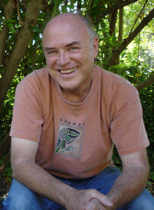
    Lawrence Bouett may be contacted directly here.

    Archives

    July 2018
    June 2018
    May 2018
    April 2018
    October 2016
    September 2015
    August 2015
    July 2015
    June 2015
    May 2015
    April 2015
    March 2015

    Categories

    All

    RSS Feed

Powered by Create your own unique website with customizable templates.
  • Home
  • About
  • History
    • Timeline
    • Street Name Histories >
      • Solano Avenue
      • Buena Vista Road
    • People of Solano >
      • Francisco Solano
      • Rosa Casanova
      • Alfredo Solano
      • María Solano
      • Guillermo Bouett
    • Photos
  • Blog
  • 1866 Org.
  • City Service Requests