|
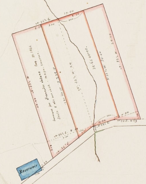
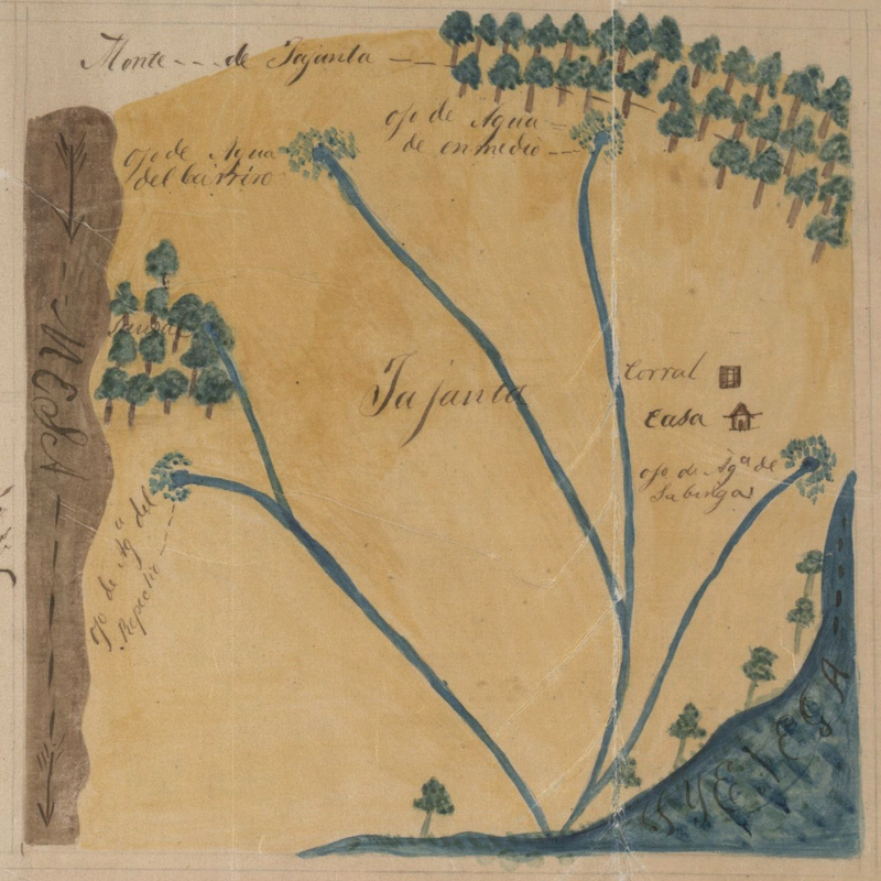
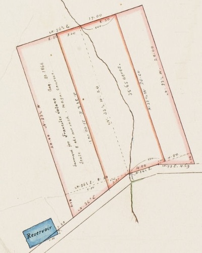
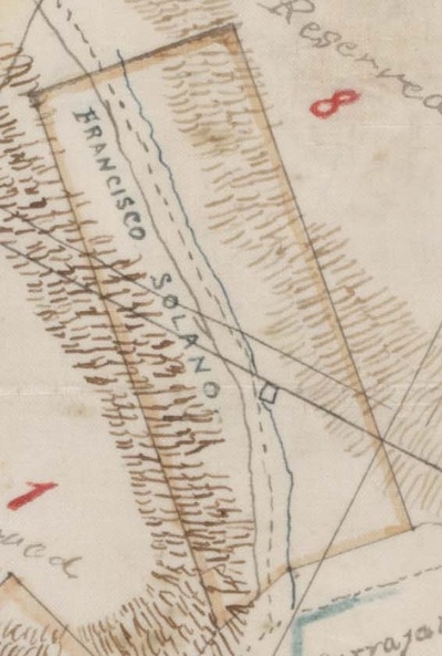
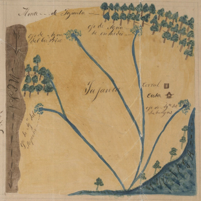
For those who want a quick tour of Solano Canyon, which will celebrate its 150th anniversary in 2016. Historic Solano Canyon is on the cusp of its sesquicentennial, the 150th anniversary of the founding of the community. This brief tour explains how Solano Canyon came to be what it is today: quite possibly, in the eyes of its residents, the best place to live in all of Los Angeles. Francisco Sales de Jesús Solano, a Costa Rican immigrant to Los Angeles in 1850, and who maintained a meat-packing business in Sonoratown, just north of the placita, had a 35-acre tract of land in an unnamed ravine in the Stone Quarry Hills surveyed on August 21, 1866. The 35-acre tract is the larger block that is outlined in red on the following map. He then petitioned the City government for title to the land. The City agreed to sell the land, but only 17 acres, which was deeded to him on September 13th and recorded on October 18th that same year, and for which, he paid the City $6. The 17-acre tract that Francisco received is the narrower block, also outlined in red, in the center of the map. Notice the stream in the center of the tract that flowed from a spring higher up in the ravine. 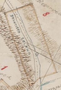 Portion of SR Map 377, The Huntington Library Portion of SR Map 377, The Huntington Library Solano immediately began to build an adobe on the stream on his newly-acquired property, and he moved his family up to the ravine, which soon became known as Solano Cañon. We know the exact location of the adobe from the map at left. The adobe is the small square on the stream immediately above the final letter "O" in "SOLANO". The dashed line to the left of the stream is a trail that went up the ravine. But Francisco Solano died suddenly on December 7, 1871 at the age of 54. He was buried in the Catholic Cemetery on Calle Eternidad, which was later called Eternity Street, then Buena Vista Road, and finally present-day North Broadway. His wife, Rosa Casanova, continued to live with her six children in Solano Cañon for several years, but she eventually took her children and moved from the ravine to the home of her mother, María Trinidad Serrano Puentes, who lived on Bath Street in downtown Los Angeles, near the plaza. Rosa remarried in 1877, and she died in 1884 at the age of 43 at another of the family's properties, Rancho Tajáuta, a portion of which was the family farm and which was located about 12 miles south of the city. Rancho la Tajáuta, which was a Gabrielino/Tongva place name, was originally a 3,560-acre Mexican land grant from 1843, and today it is the Los Angeles neighborhoods of Willowbrook and Watts. The diseño, below, is by Henry Hancock, et al, and probably dates from about 1858 or earlier. Notice the detail on the map, including the locations of a corral and a casa, a sausal (willow grove), and the four ojos de agua (springs), all of which are named. In 1888, Alfred Solano, son of Francisco Solano and Rosa Casanova, surveyed the 17-acre Solano Tract and subdivided it into 100 house lots, which were then distributed to the heirs of Francisco and Rosa. [See the blog, A Date to Remember: April 24, 1888, for more detail.] Soon, houses began to be built in Solano Canyon, and the future of the community was thereby assured. The upper part of present-day Solano Canyon, called Solano Tract No. 2, was added in 1903, and by 1940, the Solano Canyon community had more than 300 households. It is important to note that Solano Canyon, although it is a part of the area that was later called Chavez Ravine, and which included the communities of la Loma, Palo Verde, and Bishop, survived the evictions of the 1950s. An historical note: the author's father and paternal grandfather both were raised in Solano Canyon, and both attended the original Solano Avenue elementary school.
|
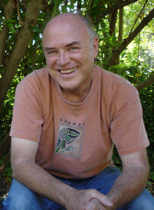
About the AuthorLawrence Bouett is a retired research scientist and registered professional engineer who now conducts historical and genealogical research full-time. A ninth-generation Californian, his primary historical research interests are Los Angeles in general and the Stone Quarry Hills in particular. His ancestors arrived in California with Portolá in 1769 and came to Los Angeles from Mission San Gabriel with the pobladores on September 4, 1781. Lawrence Bouett may be contacted directly here.
Archives
July 2018
Categories |
 RSS Feed
